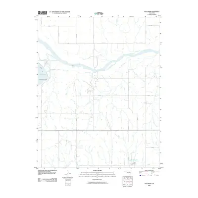
2009 Map of Watchorn
USGS Topo · Published 2009About this map
The Arkansas River winds through this Oklahoma landscape, defining the northern border of Pawnee County with a wide, braided channel that features Turkey Island at its center. This 2009 survey highlights a region managed by significant water control infrastructure, most notably the eastern edge of Sooner Lake and the engineered waters of the Lower Black Bear Creek Site 7 Reservoir. Smaller tributaries like Greasy Creek and Rock Creek carve through the agricultural grid, which is interconnected by a network of county roads including Co RD 6050 and n3400 RD.
Find a feature on this map
34 named features on this map. Tap any name to fly to it.
Don’t see what you’re looking for? This feature index may not catch every label — zoom into the map to look around manually.
Map Details
Editions of this 2009 Watchorn Map
This is the sole edition of this map. No revisions or reprints were ever made.
Other maps of this area

1930 · Pawnee
USGS Topo · 1:62,500

1936 · Belford
USGS Topo · 1:62,500

1936 · Pawnee
USGS Topo · 1:62,500

1955 · Enid
USGS Topo · 1:250,000

1958 · Enid
USGS Topo · 1:250,000

1968 · Ponca City SE
USGS Topo · 1:24,000

1972 · Morrison NE
USGS Topo · 1:24,000

1972 · Morrison
USGS Topo · 1:24,000
1978 · Prettyhair Creek
USGS Topo · 1:24,000
1978 · Pawnee
USGS Topo · 1:24,000