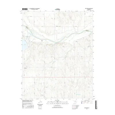
2016 Map of Watchorn
USGS Topo · Published 2016About this map
The Arkansas River winds through the borderlands of Osage and Pawnee counties, carving a path that defines the local topography and settlement patterns. To the south, the community of Watchorn sits atop the rolling terrain, while the northern bend of the river hosts the settlement of Big Bend. This area is characterized by an intricate network of waterways, including the significant Greasy Cr and Red Rock Creek, which feed into the river's main channel.
Find a feature on this map
38 named features on this map. Tap any name to fly to it.
Don’t see what you’re looking for? This feature index may not catch every label — zoom into the map to look around manually.
Map Details
Editions of this 2016 Watchorn Map
This is the sole edition of this map. No revisions or reprints were ever made.
Other maps of this area

1930 · Pawnee
USGS Topo · 1:62,500

1936 · Belford
USGS Topo · 1:62,500

1936 · Pawnee
USGS Topo · 1:62,500

1955 · Enid
USGS Topo · 1:250,000

1958 · Enid
USGS Topo · 1:250,000

1968 · Ponca City SE
USGS Topo · 1:24,000

1972 · Morrison NE
USGS Topo · 1:24,000

1972 · Morrison
USGS Topo · 1:24,000
1978 · Prettyhair Creek
USGS Topo · 1:24,000
1978 · Pawnee
USGS Topo · 1:24,000