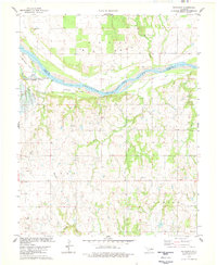
1978 Map of Watchorn
USGS Topo · Published 1978About this map
The Arkansas River serves as the dominant geographical divide for this territory, marking the boundary between Osage and Pawnee counties. The river valley is shaped by significant landforms such as Turkey Island and Beaver Island, alongside the entry of several tributaries including Red Rock Creek and Greasy Creek. This landscape reflects a heavy industrial footprint focused on energy extraction, with a widespread Oil Field and numerous Oil Wells scattered throughout the central and southern sections. Cultural and political history is evidenced by the Osage Indian Reservation Boundary and the proximity of the settlement at Watchorn. The infrastructure of the era is represented by a Pipeline, an Aqueduct, and a Pumping Station, indicating a sophisticated system for moving resources through the undulating Oklahoma terrain.
Find a feature on this map
23 named features on this map. Tap any name to fly to it.
Don’t see what you’re looking for? This feature index may not catch every label — zoom into the map to look around manually.
Map Details
Editions of this 1978 Watchorn Map
This is the sole edition of this map. No revisions or reprints were ever made.
Other maps of this area

1930 · Pawnee
USGS Topo · 1:62,500

1936 · Belford
USGS Topo · 1:62,500

1936 · Pawnee
USGS Topo · 1:62,500

1955 · Enid
USGS Topo · 1:250,000

1958 · Enid
USGS Topo · 1:250,000

1968 · Ponca City SE
USGS Topo · 1:24,000

1972 · Morrison NE
USGS Topo · 1:24,000

1972 · Morrison
USGS Topo · 1:24,000
1978 · Prettyhair Creek
USGS Topo · 1:24,000
1978 · Pawnee
USGS Topo · 1:24,000