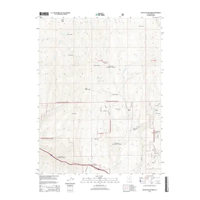
2014 Map of Water Hollow Ridge
USGS Topo · Published 2014About this map
Fishlake National Forest encompasses the vast majority of this landscape, where the high-elevation terrain of Sevier County is defined by a complex system of ridges and canyons. Notable landmarks such as Dead Horse Ridge and Water Hollow Ridge separate deep drainage basins including Water Hollow, Pine Hollow, and Chokecherry Hollow. The map reveals a network of perennial and seasonal water sources vital to this environment, ranging from Picklekeg Cr in the north to Nioche Cr in the south, supplemented by reliable points like Wigwam Spring and Conservation Spring. While the northern reaches are dominated by topographic features like Salina Flats, the southern portion shows a shift toward human interaction with the land through a series of local access routes. Roads such as Taylor Flat Rd and N Salina Creek Rd provide entry to Taylor Flat and Skutumpah Canyon, illustrating how the forest is managed and navigated for recreation and resource use.
Find a feature on this map
54 named features on this map. Tap any name to fly to it.
Don’t see what you’re looking for? This feature index may not catch every label — zoom into the map to look around manually.
Map Details
Editions of this 2014 Water Hollow Ridge Map
This is the sole edition of this map. No revisions or reprints were ever made.
Other maps of this area

1885 · Manti
USGS Topo · 1:250,000

1885 · Fish Lake
USGS Topo · 1:250,000

1895 · Manti
USGS Topo · 1:250,000

1896 · Fish Lake
USGS Topo · 1:250,000

1922 · Wasatch
USGS Topo · 1:31,680

1925 · Acord Lakes
USGS Topo · 1:62,500

1956 · Salina
USGS Topo · 1:250,000

1956 · Price
USGS Topo · 1:250,000

1960 · Price
USGS Topo · 1:250,000

1960 · Salina
USGS Topo · 1:250,000