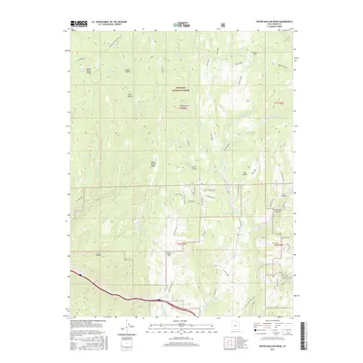
2017 Map of Water Hollow Ridge
USGS Topo · Published 2017About this map
Fishlake National Forest encompasses the majority of this high-elevation landscape in Sevier County, where a network of forest roads and historic trails navigates the varied topography. The central Water Hollow Ridge and Dead Horse Ridge divide numerous drainages, including Commissary Cr and Salina Cr. Evidence of seasonal water and early range use is found at Wigwam Spring, Wikiup Spring, and Conservation Spring. Modern access is defined by the Great Western Trail (D-4) and the Convulsion Canyon Road which skirts the southeastern corner of the quadrangle. The map reveals a transition from the broad, open Salina Flats in the northeast to the sharp relief of Skutumpah Canyon and Coal Hollow, illustrating the diverse terrain of the Wasatch Plateau.
Find a feature on this map
65 named features on this map. Tap any name to fly to it.
Don’t see what you’re looking for? This feature index may not catch every label — zoom into the map to look around manually.
Map Details
Editions of this 2017 Water Hollow Ridge Map
This is the sole edition of this map. No revisions or reprints were ever made.
Other maps of this area

1885 · Manti
USGS Topo · 1:250,000

1885 · Fish Lake
USGS Topo · 1:250,000

1895 · Manti
USGS Topo · 1:250,000

1896 · Fish Lake
USGS Topo · 1:250,000

1922 · Wasatch
USGS Topo · 1:31,680

1925 · Acord Lakes
USGS Topo · 1:62,500

1956 · Salina
USGS Topo · 1:250,000

1956 · Price
USGS Topo · 1:250,000

1960 · Price
USGS Topo · 1:250,000

1960 · Salina
USGS Topo · 1:250,000