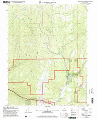
2001 Map of Water Hollow Ridge
USGS Topo · Published 2003About this map
Fishlake National Forest contains a complex network of canyons and high ridges across this Sevier County landscape, updated by the Forest Service in 2001. The terrain is defined by Water Hollow Ridge and Dead Horse Ridge, which overlook a series of vital water sources including Wigwam Spring, Willow Spring, and the Flowing Well. These points suggest the historical importance of water management in an area used for both conservation and industry.
Find a feature on this map
36 named features on this map. Tap any name to fly to it.
Don’t see what you’re looking for? This feature index may not catch every label — zoom into the map to look around manually.
Map Details
Editions of this 2001 Water Hollow Ridge Map
This is the sole edition of this map. No revisions or reprints were ever made.
Other maps of this area

1885 · Manti
USGS Topo · 1:250,000

1885 · Fish Lake
USGS Topo · 1:250,000

1895 · Manti
USGS Topo · 1:250,000

1896 · Fish Lake
USGS Topo · 1:250,000

1922 · Wasatch
USGS Topo · 1:31,680

1925 · Acord Lakes
USGS Topo · 1:62,500

1956 · Salina
USGS Topo · 1:250,000

1956 · Price
USGS Topo · 1:250,000

1960 · Price
USGS Topo · 1:250,000

1960 · Salina
USGS Topo · 1:250,000