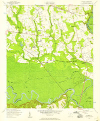
1953 Map of Wateree
USGS Topo · Published 1957About this map
Kingville and the winding bottomlands of the Congaree River anchor this mid-century survey of the South Carolina lowcountry. The landscape is defined by the convergence of the Southern and Atlantic Coast Line railroads, which facilitated local trade near the Wateree settlement and the Wateree River. To the south, the river forms a complex series of oxbows and swampy reaches, including Devils Elbow, Bates Old River, and the marshy expanses of Fork Swamp.
Find a feature on this map
55 named features on this map. Tap any name to fly to it.
Don’t see what you’re looking for? This feature index may not catch every label — zoom into the map to look around manually.
Map Details
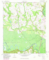
Editions of this 1953 Wateree Map
4 editions found
Other maps of this area

1943 · Eastover
USGS Topo · 1:62,500

1946 · Elloree
USGS Topo · 1:62,500

1946 · St. Matthews
USGS Topo · 1:62,500

1948 · Hopkins
USGS Topo · 1:62,500

1953 · Poinsett State Park
USGS Topo · 1:24,000

1953 · Eastover
USGS Topo · 1:24,000

1953 · Wedgefield
USGS Topo · 1:24,000
1953 · Congaree
USGS Topo · 1:24,000

1953 · Gadsden
USGS Topo · 1:24,000

1953 · Wateree
USGS Topo · 1:24,000