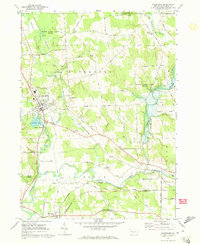
1967 Map of Waterford
USGS Topo · Published 1973About this map
Waterford and its surrounding townships in Erie County reflect a landscape defined by the convergence of rail and river during the late 1960s. The town sits at a geographic junction where Trout Run meets Le Boeuf Creek, just north of Le Boeuf Lake. The infrastructure of the era is prominently mapped, showing the Penn Central and Erie-Lackawanna railroads threading through the valley alongside rural settlements like Mill Village and Wheelertown.
Find a feature on this map
56 named features on this map. Tap any name to fly to it.
Don’t see what you’re looking for? This feature index may not catch every label — zoom into the map to look around manually.
Map Details
Editions of this 1967 Waterford Map
3 editions found
Other maps of this area

1899 · Erie
USGS Topo · 1:62,500

1900 · Erie
USGS Topo · 1:62,500

1913 · North East
USGS Topo · 1:62,500

1915 · North East
USGS Topo · 1:62,500

1923 · Cambridge Springs
USGS Topo · 1:62,500

1925 · Cambridge Springs
USGS Topo · 1:62,500

1929 · Union City
USGS Topo · 1:62,500

1932 · Union City
USGS Topo · 1:62,500

1943 · North East
USGS Topo · 1:62,500

1943 · Cambridge Springs
USGS Topo · 1:62,500