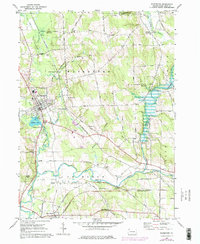
1967 Map of Waterford
USGS Topo · Published 1976About this map
Waterford serves as the primary hub of this landscape, situated along the northern shores of Le Boeuf Lake. The town is characterized by a dense grid of streets and key local landmarks like the St Cypriana Ch and the High Sch. The surrounding countryside is a network of small settlements and family farmsteads connected by roads such as Wheelertown Road and Middleton Road. South of town, French Creek winds through the flats, its course traced by the Penn Central and Erie-Lackawanna railroads, which emphasize the area's role as a transportation corridor.
Find a feature on this map
65 named features on this map. Tap any name to fly to it.
Don’t see what you’re looking for? This feature index may not catch every label — zoom into the map to look around manually.
Map Details
Editions of this 1967 Waterford Map
3 editions found
Other maps of this area

1899 · Erie
USGS Topo · 1:62,500

1900 · Erie
USGS Topo · 1:62,500

1913 · North East
USGS Topo · 1:62,500

1915 · North East
USGS Topo · 1:62,500

1923 · Cambridge Springs
USGS Topo · 1:62,500

1925 · Cambridge Springs
USGS Topo · 1:62,500

1929 · Union City
USGS Topo · 1:62,500

1932 · Union City
USGS Topo · 1:62,500

1943 · North East
USGS Topo · 1:62,500

1943 · Cambridge Springs
USGS Topo · 1:62,500