
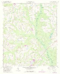
1973 Map of Waterloo
USGS Topo · Published 1975About this map
The Alapaha River corridor dominates this south-central Georgia landscape, where a complex network of wetlands and namesake lakes such as Horse Ford Lake and Shiket Lake define the river's path through Turner, Irwin, and Tift counties. In the early 1970s, the small settlement of Waterloo served as a local hub near the northwestern corner, anchored by nearby cemeteries and rural congregations like Macedonia Ch. The topography reveals a land heavily influenced by water, with numerous minor waterways like Log Creek and Little Sand Creek feeding into the river system. To the south, the community of Harding sits along a railroad line, adjacent to industrial landmarks like a Sandpit and several smaller lakes including Gun Lake and Goodman Lake. This survey illustrates a quiet agricultural and timber-oriented era, where travel relied on a mix of local roads and primitive Jeep Trails through the river bottomlands.
Find a feature on this map
41 named features on this map. Tap any name to fly to it.
Don’t see what you’re looking for? This feature index may not catch every label — zoom into the map to look around manually.
Map Details
Editions of this 1973 Waterloo Map
2 editions found
Other maps of this area

1953 · Waycross
USGS Topo · 1:250,000

1958 · Waycross
USGS Topo · 1:250,000

1973 · Ocilla West
USGS Topo · 1:24,000

1973 · Irwinville
USGS Topo · 1:24,000

1973 · Enigma
USGS Topo · 1:24,000

1973 · Chula
USGS Topo · 1:24,000

1973 · Tifton East
USGS Topo · 1:24,000

1973 · Tifton West
USGS Topo · 1:24,000

1973 · Bethel
USGS Topo · 1:24,000

1973 · Fitzgerald West
USGS Topo · 1:24,000