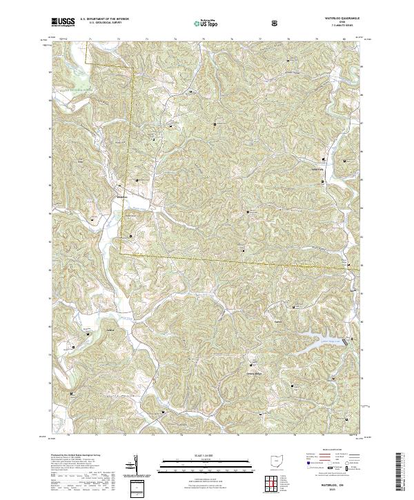
2023 Map of Waterloo
USGS Topo · Published 2023About this map
Symmes Creek and its many tributaries, including Buck Creek and Johns Creek, carve through the complex ridge-and-hollow topography of Lawrence County. This 2023 survey of the area near Waterloo and Arabia reveals a landscape where modern boundaries of the Wayne National Forest overlay a deep history of family homesteads and local congregations. The map is particularly dense with small, family-named burial grounds like Saunders Cem, Haskins Cem, and Drummond Cem, which provide a geographic anchor for genealogical research along the high ground of Greasy Ridge and Jenkins Ridge. In the southern reaches, Ellsworth Ridge and the waters of Timber Ridge Lake highlight the area's rural character, while the intersection of Lawrence and Gallia counties underscores the jurisdictional history of these southern Ohio hill country settlements.
Find a feature on this map
76 named features on this map. Tap any name to fly to it.
Don’t see what you’re looking for? This feature index may not catch every label — zoom into the map to look around manually.
Map Details
Editions of this 2023 Waterloo Map
This is the sole edition of this map. No revisions or reprints were ever made.
Other maps of this area

1898 · Ironton
USGS Topo · 1:62,500

1900 · Ironton
USGS Topo · 1:62,500

1906 · Bidwell
USGS Topo · 1:62,500

1906 · Athalia
USGS Topo · 1:62,500

1908 · Bidwell
USGS Topo · 1:62,500

1908 · Athalia
USGS Topo · 1:62,500

1912 · Oak Hill
USGS Topo · 1:62,500

1957 · Huntington
USGS Topo · 1:250,000
1958 · Athalia
USGS Topo · 1:24,000

1960 · Huntington
USGS Topo · 1:250,000