
2002 Map of Waterloo
USGS Topo · Published 2006About this map
The Wayne National Forest dominates this section of southern Ohio, where the landscape is defined by the steep ridges and narrow hollows characteristic of the Appalachian Plateau. Settlements such as Waterloo and Arabia are positioned along the winding course of Symmes Creek, while Wilgus and Lecta sit further east toward the Crown City Wilderness Area. The map reveals a land utilized for both timber and coal, showing several locations marked as Strip Mine and Reclaimed Strip Mine, reflecting the region's industrial heritage.
Find a feature on this map
60 named features on this map. Tap any name to fly to it.
Don’t see what you’re looking for? This feature index may not catch every label — zoom into the map to look around manually.
Map Details
Editions of this 2002 Waterloo Map
This is the sole edition of this map. No revisions or reprints were ever made.
Other maps of this area

1898 · Ironton
USGS Topo · 1:62,500

1900 · Ironton
USGS Topo · 1:62,500

1906 · Bidwell
USGS Topo · 1:62,500

1906 · Athalia
USGS Topo · 1:62,500

1908 · Bidwell
USGS Topo · 1:62,500

1908 · Athalia
USGS Topo · 1:62,500

1912 · Oak Hill
USGS Topo · 1:62,500

1957 · Huntington
USGS Topo · 1:250,000
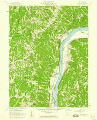
1958 · Athalia
USGS Topo · 1:24,000

1960 · Huntington
USGS Topo · 1:250,000