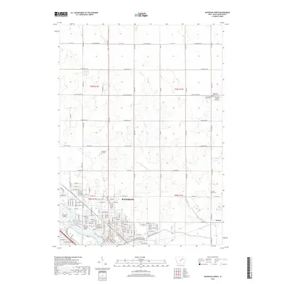
2018 Map of Waterloo North
USGS Topo · Published 2018About this map
Waterloo sits along the Cedar River in this 2018 survey, which shows the city's northern expansion and the rural-urban interface of Black Hawk County. The river corridor is particularly notable for its distinct islands, including San Souci Island and the evocatively named Robinson Crusoe Island near the city's western edge. The northern landscape is predominantly agricultural, partitioned by a grid of county highways like Co HWY c57 and rural routes such as W Bennington Rd.
Find a feature on this map
149 named features on this map. Tap any name to fly to it.
Don’t see what you’re looking for? This feature index may not catch every label — zoom into the map to look around manually.
Map Details
Editions of this 2018 Waterloo North Map
This is the sole edition of this map. No revisions or reprints were ever made.
Other maps of this area

1954 · Waterloo
USGS Topo · 1:250,000

1955 · Waterloo
USGS Topo · 1:250,000

1963 · Waverly
USGS Topo · 1:24,000

1963 · Denver
USGS Topo · 1:24,000

1963 · Hudson
USGS Topo · 1:24,000

1963 · Waterloo South
USGS Topo · 1:24,000

1963 · Cedar Falls
USGS Topo · 1:24,000

1963 · Waterloo North
USGS Topo · 1:24,000

1971 · Readlyn
USGS Topo · 1:24,000

1971 · Gilbertville
USGS Topo · 1:24,000