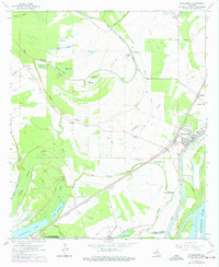
1963 Map of Waterproof
USGS Topo · Published 1977About this map
The Mississippi River and its shifting oxbows dominate this mid-century view of the Louisiana delta country. The settlement of Waterproof serves as a primary hub along the Missouri Pacific railroad, reflecting a landscape defined by large-scale agricultural operations like Arcola Plantation and Winona Plantation. The intricate hydrography of the region is evident in the complex network of Tensas River and Little Tensas Bayou, alongside permanent water bodies such as St John Lake and Lake St John.
Find a feature on this map
51 named features on this map. Tap any name to fly to it.
Don’t see what you’re looking for? This feature index may not catch every label — zoom into the map to look around manually.
Map Details
Editions of this 1963 Waterproof Map
2 editions found
Other maps of this area

1909 · Delta Bridge
USGS Topo · 1:24,000

1921 · Natchez
USGS Topo · 1:48,000

1922 · Natchez
USGS Topo · 1:62,500

1939 · Red Gum
USGS Topo · 1:62,500

1939 · Natchez
USGS Topo · 1:62,500

1939 · Locust Ridge
USGS Topo · 1:62,500

1941 · Sicily Island
USGS Topo · 1:62,500

1953 · Natchez
USGS Topo · 1:250,000

1956 · Natchez
USGS Topo · 1:250,000

1957 · Sicily Island
USGS Topo · 1:62,500