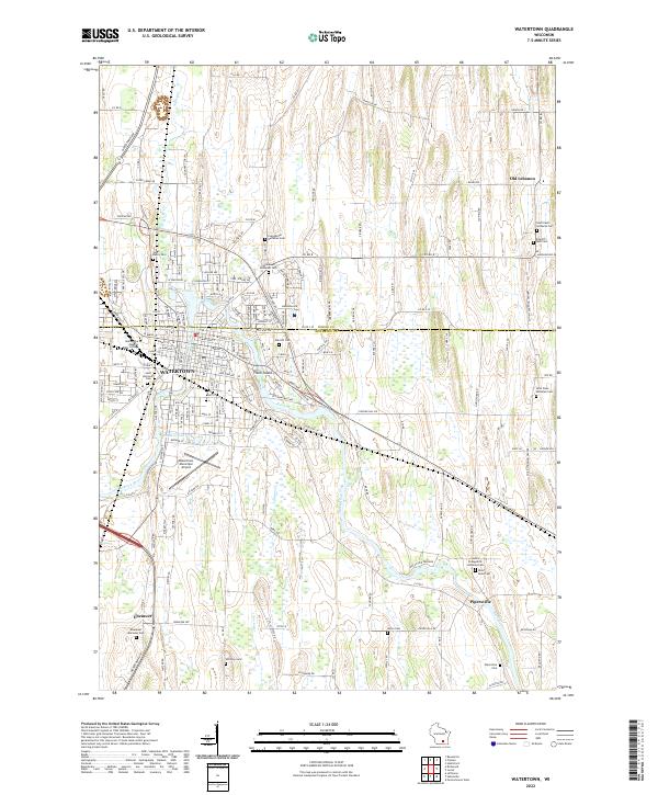
2022 Map of Watertown
USGS Topo · Published 2022About this map
The city of Watertown straddles the border of Dodge and Jefferson Counties, defined by the winding course of the Rock River. This modern survey reveals the city's residential and institutional layout, notably featuring the Maranatha Baptist Bible College campus and Tivoli Island near the city center. The landscape is dotted with numerous religious sites and burial grounds, such as Saint Bernards Cem and the Ebenezer Moravian Cem, reflecting the area's long-established community roots.
Find a feature on this map
68 named features on this map. Tap any name to fly to it.
Don’t see what you’re looking for? This feature index may not catch every label — zoom into the map to look around manually.
Map Details
Editions of this 2022 Watertown Map
This is the sole edition of this map. No revisions or reprints were ever made.
Historical Maps of Old Lebanon Through Time
5 maps found