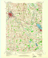
1959 Map of Watertown
USGS Topo · Published 1972About this map
Watertown serves as the focal point of this late 1950s landscape, where the Rock River winds through the city before heading south toward Pipersville. The region is defined by a dense network of rural infrastructure, including numerous family-named schools and cemeteries that testify to the established farming communities of the mid-20th century. To the west, the Chicago And North Western railroad corridor parallels the river, while the Chicago Milwaukee ST Paul And Pacific line crosses the eastern half of the quadrangle through Ixonia.
Find a feature on this map
91 named features on this map. Tap any name to fly to it.
Don’t see what you’re looking for? This feature index may not catch every label — zoom into the map to look around manually.
Map Details
Editions of this 1959 Watertown Map
3 editions found
Other maps of this area

1891 · Waterloo
USGS Topo · 1:62,500

1891 · Koshkonong
USGS Topo · 1:62,500

1892 · Watertown
USGS Topo · 1:62,500

1892 · Oconomowoc
USGS Topo · 1:62,500

1892 · Whitewater
USGS Topo · 1:62,500

1892 · Eagle
USGS Topo · 1:62,500

1893 · Whitewater
USGS Topo · 1:62,500

1894 · Waterloo
USGS Topo · 1:62,500

1894 · Watertown
USGS Topo · 1:62,500

1894 · Eagle
USGS Topo · 1:62,500