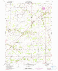
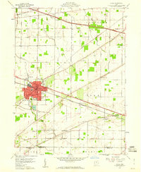
1960 Map of Watson
USGS Topo · Published 1990About this map
The Old Indian Treaty Boundary carves a distinctive diagonal through these Seneca County townships, marking a historical division of the landscape that persists in the property lines and road layouts of the 1960s. Rural life is anchored by small crossroads and family legacies, evidenced by numerous burial grounds including Raymond Cem and Coffman Cem. The local economy and transport are defined by the Penn Central railroad corridors and the path of the Old Indian Road, which skirt the winding banks of Sugar Creek and Beaver Creek. From the village of Lowell to the northern edge of Republic, the map reveals a meticulously drained agricultural interior where features like the Westerhouse Ditch and a network of pipelines highlight the 20th-century modernization of this traditional farming region. Faith remains a central fixture of the community at St Jacobs Ch and Pleasant Ridge Ch.
Find a feature on this map
30 named features on this map. Tap any name to fly to it.
Don’t see what you’re looking for? This feature index may not catch every label — zoom into the map to look around manually.
Map Details
Editions of this 1960 Watson Map
3 editions found
Other maps of this area

1901 · Bellevue
USGS Topo · 1:62,500

1901 · Fremont
USGS Topo · 1:62,500

1903 · Bellevue
USGS Topo · 1:62,500

1903 · Fremont
USGS Topo · 1:62,500

1906 · Tiffin
USGS Topo · 1:62,500

1915 · Siam
USGS Topo · 1:62,500

1956 · Toledo
USGS Topo · 1:250,000

1958 · Fremont West
USGS Topo · 1:24,000
1958 · Fremont East
USGS Topo · 1:24,000
1959 · Clyde
USGS Topo · 1:24,000