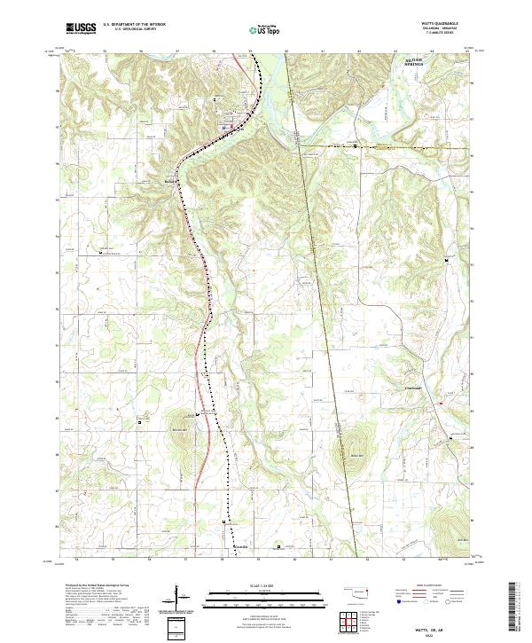
2022 Map of Watts
USGS Topo · Published 2022About this map
Watts serves as a primary hub in this borderland survey, situated where the Illinois River flows through northeastern Oklahoma. The landscape is defined by its transition from the river valley to the prominent heights of Mission Mtn and Bates Mtn, which overlook a network of creek drainages including Ballard Cr and Peacheater Cr. This area is rich in local history, marked by several family and community burial grounds like Sixkiller Cem and Lacie Cem. A point of significant interest is the Reverend Jesse Bushyhead Grave near Baptist Mission Cem, documenting the deep cultural roots of this region. The settlement pattern follows the established county roads and the state line between Adair County, Oklahoma, and Washington County, Arkansas, with Ballard and Westville anchoring the southern corridor and Cincinnati resting just across the border to the east.
Find a feature on this map
91 named features on this map. Tap any name to fly to it.
Don’t see what you’re looking for? This feature index may not catch every label — zoom into the map to look around manually.
Map Details
Editions of this 2022 Watts Map
This is the sole edition of this map. No revisions or reprints were ever made.
Other maps of this area

1898 · Tahlequah
USGS Topo · 1:125,000

1898 · Winslow
USGS Topo · 1:125,000

1899 · Fayetteville
USGS Topo · 1:125,000

1899 · Siloam Springs
USGS Topo · 1:125,000

1901 · Winslow
USGS Topo · 1:125,000

1901 · Fayetteville
USGS Topo · 1:125,000

1901 · Tahlequah
USGS Topo · 1:125,000

1903 · Siloam Springs
USGS Topo · 1:125,000

1904 · Siloam Springs
USGS Topo · 1:125,000

1904 · Fayetteville
USGS Topo · 1:125,000