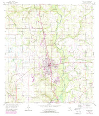
1955 Map of Wauchula
USGS Topo · Published 1988About this map
Wauchula serves as the central hub of this Hardee County survey, situated along the Peace River and the Seaboard System railroad. The map documents the mid-century transition of the Florida interior, where established towns like Zolfo Springs and Torrey are complemented by emerging developments such as a Drive-in Theater and several Trailer Parks. The landscape is defined by an intricate network of water, including Troublesome Creek, Payne Creek, and the dense Reaphook Swamp to the west. Local genealogy and community life are grounded in the presence of the Wauchula Cemetery and rural congregations at Lake Dale Church and New Hope Church. The topography indicates a reliance on the river and rail corridors for commerce, with small siding-related settlements like Coker marking the railway's path northward toward the Torrey area.
Find a feature on this map
27 named features on this map. Tap any name to fly to it.
Don’t see what you’re looking for? This feature index may not catch every label — zoom into the map to look around manually.
Map Details
Editions of this 1955 Wauchula Map
4 editions found
Other maps of this area

1955 · Ft. Green
USGS Topo · 1:24,000

1955 · Bowling Green
USGS Topo · 1:24,000

1955 · Wauchula
USGS Topo · 1:24,000

1955 · Baird
USGS Topo · 1:24,000

1956 · Ona
USGS Topo · 1:24,000

1956 · Bereah
USGS Topo · 1:24,000

1956 · Sweetwater
USGS Topo · 1:24,000

1956 · Zolfo Springs
USGS Topo · 1:24,000

1956 · Griffins Corner
USGS Topo · 1:24,000

1956 · Fort Pierce
USGS Topo · 1:250,000