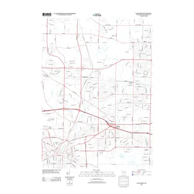
2013 Map of Waukesha
USGS Topo · Published 2013About this map
The Fox River and Pewaukee River converge near the heart of this urban and suburban landscape, which retains traces of its development through the mid-20th century. Named settlements such as Duplainville and Marcy anchor the northern and central portions of the sheet, while Goerkes Corner and Calhoun mark historic transit and commerce points to the south and east. The map shows a region defined by established recreational and civic hubs, including the Waukesha County Fairgrounds, Wanaki Golf Course, and Moor Downs Golf Course. Transportation infrastructure is a dominant theme, evidenced by the presence of both the Capitol Airport and Waukesha County Airport. Local history and geology are uniquely represented by Silurian Spring, a specific natural feature that stands out amid the modern street network. This survey captures a moment of dense residential growth integrated with large-scale public facilities and preserved riparian corridors.
Find a feature on this map
225 named features on this map. Tap any name to fly to it.
Don’t see what you’re looking for? This feature index may not catch every label — zoom into the map to look around manually.
Map Details
Editions of this 2013 Waukesha Map
This is the sole edition of this map. No revisions or reprints were ever made.
Other maps of this area

1891 · Muskego
USGS Topo · 1:62,500

1892 · Waukesha
USGS Topo · 1:62,500

1892 · Oconomowoc
USGS Topo · 1:62,500

1892 · Eagle
USGS Topo · 1:62,500

1894 · Eagle
USGS Topo · 1:62,500

1897 · Eagle
USGS Topo · 1:62,500

1901 · Waukesha
USGS Topo · 1:62,500

1901 · Muskego
USGS Topo · 1:62,500

1906 · Eagle
USGS Topo · 1:62,500

1906 · Waukesha
USGS Topo · 1:62,500