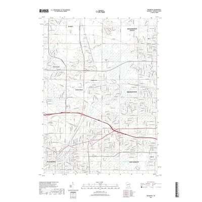
2018 Map of Waukesha
USGS Topo · Published 2018About this map
The Fox River meanders southward through this suburbanizing landscape, connecting the diverse communities of Waukesha, Brookfield, and Pewaukee during the late 2010s. This detailed survey documents the intersection of legacy agriculture and modern expansion, where family-named landmarks like Marcy and the rail junction of Duplainville sit alongside growing residential networks. Genealogists can locate several historic burial grounds, including the Pilgrims Rest Cem, Saint Joseph Cem, and Oak Hill Cem.
Find a feature on this map
51 named features on this map. Tap any name to fly to it.
Don’t see what you’re looking for? This feature index may not catch every label — zoom into the map to look around manually.
Map Details
Editions of this 2018 Waukesha Map
This is the sole edition of this map. No revisions or reprints were ever made.
Other maps of this area

1891 · Muskego
USGS Topo · 1:62,500

1892 · Waukesha
USGS Topo · 1:62,500

1892 · Oconomowoc
USGS Topo · 1:62,500

1892 · Eagle
USGS Topo · 1:62,500

1894 · Eagle
USGS Topo · 1:62,500

1897 · Eagle
USGS Topo · 1:62,500

1901 · Waukesha
USGS Topo · 1:62,500

1901 · Muskego
USGS Topo · 1:62,500

1906 · Eagle
USGS Topo · 1:62,500

1906 · Waukesha
USGS Topo · 1:62,500