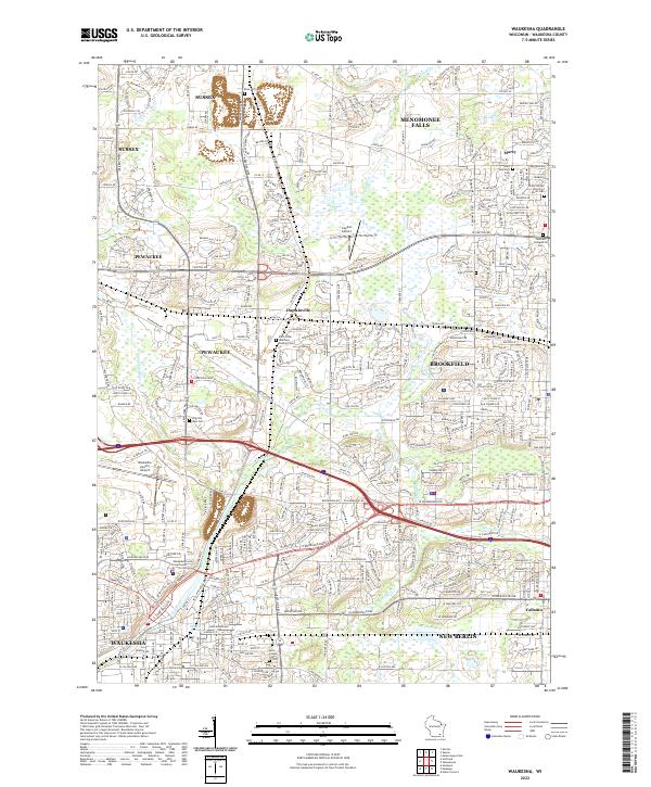
2022 Map of Waukesha
USGS Topo · Published 2022About this map
Waukesha anchors the southern portion of this modern survey, where the Fox River flows past the Waukesha County Courthouse and the campus of Carroll University. The landscape reflects a densely developed suburban and industrial corridor connecting Pewaukee, Brookfield, and Menomonee Falls. This area is defined by a heavy transportation network, including the Canadian Pacific rail line and major thoroughfares like Bluemound Rd and W Capitol Dr.
Find a feature on this map
106 named features on this map. Tap any name to fly to it.
Don’t see what you’re looking for? This feature index may not catch every label — zoom into the map to look around manually.
Map Details
Editions of this 2022 Waukesha Map
This is the sole edition of this map. No revisions or reprints were ever made.
Other maps of this area

1891 · Muskego
USGS Topo · 1:62,500

1892 · Waukesha
USGS Topo · 1:62,500

1892 · Oconomowoc
USGS Topo · 1:62,500

1892 · Eagle
USGS Topo · 1:62,500

1894 · Eagle
USGS Topo · 1:62,500

1897 · Eagle
USGS Topo · 1:62,500

1901 · Waukesha
USGS Topo · 1:62,500

1901 · Muskego
USGS Topo · 1:62,500

1906 · Eagle
USGS Topo · 1:62,500

1906 · Waukesha
USGS Topo · 1:62,500