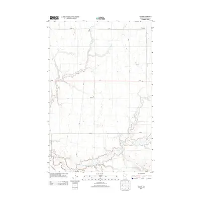
2013 Map of Waukon
USGS Topo · Published 2013About this map
The Wild Rice River meanders through this agricultural section of Norman County, defining the southern landscape with its intricate oxbows and riparian curves. This 2013 survey of the Waukon area highlights a traditional Midwestern settlement pattern where small rural cemeteries serve as the primary landmarks for local history. Researchers can locate Saint Petri Cem in the north, Immanuel Cem along Mashaug Cr, and Hlubek Cem centrally positioned between the creek and the river. The terrain is further shaped by the Garden Slough and the winding course of Marsh Cr to the east. Transportation is anchored by the crossing of MN-200, which bisects the quadrangle, and several county routes including Co HWY-19 and Co HWY-29, providing a framework for the scattered farmsteads and agricultural plots characteristic of this Minnesota region.
Find a feature on this map
13 named features on this map. Tap any name to fly to it.
Don’t see what you’re looking for? This feature index may not catch every label — zoom into the map to look around manually.
Map Details
Editions of this 2013 Waukon Map
This is the sole edition of this map. No revisions or reprints were ever made.
Other maps of this area

1918 · Twin Valley
USGS Topo · 1:62,500

1918 · Flom
USGS Topo · 1:62,500

1918 · Ulen
USGS Topo · 1:62,500

1952 · Grand Forks
USGS Topo · 1:250,000

1956 · Grand Forks
USGS Topo · 1:250,000

1965 · Waukon
USGS Topo · 1:24,000

1965 · Twin Valley
USGS Topo · 1:24,000

1965 · Syre
USGS Topo · 1:24,000

1965 · Flaming
USGS Topo · 1:24,000

1966 · Flom
USGS Topo · 1:24,000