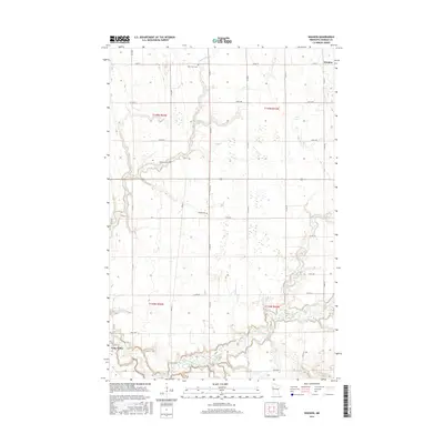
2016 Map of Waukon
USGS Topo · Published 2016About this map
Twin Valley sits in the southwestern corner of this survey, where the Wild Rice River winds through the landscape of Norman County. This area is defined by a grid of rural roads and scattered water features such as Garden Slough and Marsh Cr, reflecting the agricultural nature of the region. The map preserves the locations of several small community anchors, including Saint Petri Cem, Immanuel Cem, and Hlubek Cem, which are vital for genealogical research in this part of Minnesota. The settlement of Waukon is positioned in the northeast, connected to the surrounding countryside by a network of county roads like Co RD 19. The serpentine path of Mashaug Cr and the river's floodplains contrast with the precision of the Public Land Survey System boundaries that divide the townships.
Find a feature on this map
25 named features on this map. Tap any name to fly to it.
Don’t see what you’re looking for? This feature index may not catch every label — zoom into the map to look around manually.
Map Details
Editions of this 2016 Waukon Map
This is the sole edition of this map. No revisions or reprints were ever made.
Other maps of this area

1918 · Twin Valley
USGS Topo · 1:62,500

1918 · Flom
USGS Topo · 1:62,500

1918 · Ulen
USGS Topo · 1:62,500

1952 · Grand Forks
USGS Topo · 1:250,000

1956 · Grand Forks
USGS Topo · 1:250,000

1965 · Waukon
USGS Topo · 1:24,000

1965 · Twin Valley
USGS Topo · 1:24,000

1965 · Syre
USGS Topo · 1:24,000

1965 · Flaming
USGS Topo · 1:24,000

1966 · Flom
USGS Topo · 1:24,000