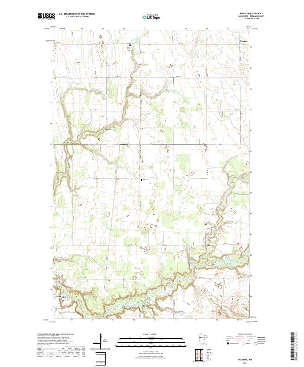
2022 Map of Waukon
USGS Topo · Published 2022About this map
The Wild Rice River meanders across this rural section of Norman County, defining the southern landscape near the edge of Twin Valley. This 2022 survey captures the persistent agricultural grid of the Red River Valley region, where small community centers like Waukon are interconnected by a network of county roads. For genealogists and local historians, the map is a precise record of historical burial sites, including Saint Petri Cem in the north and Immanuel Cem further south. The drainage patterns are clearly marked by Garden Slough, Mashaug Cr, and Marsh Cr, which feed into the primary river system. This contemporary look at the township boundaries of t145n r44w and t144n r44w shows how the modern landscape still adheres to the early public land survey system lines established during settlement.
Find a feature on this map
25 named features on this map. Tap any name to fly to it.
Don’t see what you’re looking for? This feature index may not catch every label — zoom into the map to look around manually.
Map Details
Editions of this 2022 Waukon Map
This is the sole edition of this map. No revisions or reprints were ever made.
Other maps of this area

1918 · Twin Valley
USGS Topo · 1:62,500

1918 · Flom
USGS Topo · 1:62,500

1918 · Ulen
USGS Topo · 1:62,500

1952 · Grand Forks
USGS Topo · 1:250,000

1956 · Grand Forks
USGS Topo · 1:250,000

1965 · Waukon
USGS Topo · 1:24,000

1965 · Twin Valley
USGS Topo · 1:24,000

1965 · Syre
USGS Topo · 1:24,000

1965 · Flaming
USGS Topo · 1:24,000

1966 · Flom
USGS Topo · 1:24,000