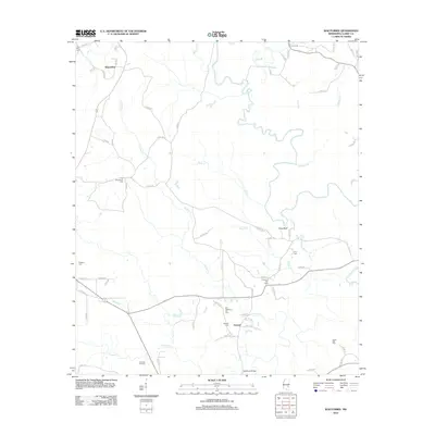
2012 Map of Wautubbee
USGS Topo · Published 2012About this map
The Chickasawhay River and its meandering tributaries, including Green Br and Alligator Br, carve through this section of Clarke County, creating a landscape defined by water and oil. Industrial activity is centered on the Pachuta Oil Field in the southwest, while small rural settlements like Wautubbee and Elwood serve as local anchors. For genealogists, the map is remarkably dense with burial sites, many reflecting early family or community ties, such as Old Souenlovie Cem, Old Pleasant Hill Cem, and White Oak Cem. The presence of both an original and a current Pleasant Hill Cem suggests a shift in community center over time. Elevation and terrain are most notable at King Bluff overlooking the river valley, providing a clear picture of the region's physical geography in the early 21st century.
Find a feature on this map
71 named features on this map. Tap any name to fly to it.
Don’t see what you’re looking for? This feature index may not catch every label — zoom into the map to look around manually.
Map Details
Editions of this 2012 Wautubbee Map
This is the sole edition of this map. No revisions or reprints were ever made.
Other maps of this area

1953 · Hattiesburg
USGS Topo · 1:250,000

1953 · Meridian
USGS Topo · 1:250,000

1957 · Meridian
USGS Topo · 1:250,000

1957 · Quitman
USGS Topo · 1:62,500

1957 · Enterprise
USGS Topo · 1:62,500

1958 · Hattiesburg
USGS Topo · 1:250,000

1963 · Heidelberg
USGS Topo · 1:24,000

1964 · Hale
USGS Topo · 1:24,000

1964 · De Soto
USGS Topo · 1:24,000

1965 · Meridian
USGS Topo · 1:250,000