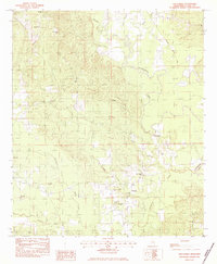
1983 Map of Wautubbee
USGS Topo · Published 1983About this map
Pachuta and the small settlement of Elwood anchor this 1983 survey of Clarke County, where the southern Mississippi landscape is defined by a dense network of creeks feeding the Chickasawhay River. The area's development follows the dual paths of the Southern and Illinois Central Gulf railroads, which cut through the hilly terrain alongside the Gordon Creek and Souenlouie Creek drainages. Genealogy value is high throughout the quadrangle, with numerous family-centered landmarks such as King Bluff and McCants Branch. The map preserves the locations of many rural centers of community life, including the Old Souenlouie Cemetery and a variety of country churches ranging from Bethlehem Church in the north to White Oak Church in the southeast corner. The distribution of these sites, alongside labels like Old Pleasant Hill Cemetery, suggests the long-standing settlement patterns of these woodland communities before modern highway expansion.
Find a feature on this map
35 named features on this map. Tap any name to fly to it.
Don’t see what you’re looking for? This feature index may not catch every label — zoom into the map to look around manually.
Map Details
Editions of this 1983 Wautubbee Map
This is the sole edition of this map. No revisions or reprints were ever made.
Other maps of this area

1953 · Hattiesburg
USGS Topo · 1:250,000

1953 · Meridian
USGS Topo · 1:250,000

1957 · Meridian
USGS Topo · 1:250,000

1957 · Quitman
USGS Topo · 1:62,500

1957 · Enterprise
USGS Topo · 1:62,500

1958 · Hattiesburg
USGS Topo · 1:250,000

1963 · Heidelberg
USGS Topo · 1:24,000

1964 · Hale
USGS Topo · 1:24,000

1964 · De Soto
USGS Topo · 1:24,000

1965 · Meridian
USGS Topo · 1:250,000