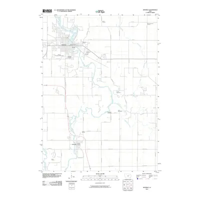
2010 Map of Waverly
USGS Topo · Published 2010About this map
The Cedar River winds through the heart of this landscape, anchoring the city of Waverly and the community of Janesville to the south. This survey reveals a dense network of local cemeteries, including Harlington Cemetery, Saint Marys Cemetery, and Saint Josephs Cemetery, which are essential for genealogical research in Bremer County. The river's path is joined by several tributaries such as Baskins Run and Quarter Section Run, while the Shell Rock River enters at the southwestern corner. Beyond the residential areas and the Waverly Post Office, the map details recreational sites like the Waverly Municipal Golf Course and youth camps including Camp Ingawanis and Camp Sacajawea. The grid-like road system, featuring routes like Bremer Rd and Garden Ave, highlights the transition from the structured street plan of the city to the expansive agricultural plots of the surrounding Iowa countryside.
Find a feature on this map
61 named features on this map. Tap any name to fly to it.
Don’t see what you’re looking for? This feature index may not catch every label — zoom into the map to look around manually.
Map Details
Editions of this 2010 Waverly Map
This is the sole edition of this map. No revisions or reprints were ever made.
Other maps of this area

1954 · Waterloo
USGS Topo · 1:250,000

1955 · Waterloo
USGS Topo · 1:250,000

1963 · Waverly
USGS Topo · 1:24,000

1963 · Denver
USGS Topo · 1:24,000

1963 · Cedar Falls
USGS Topo · 1:24,000

1963 · Waterloo North
USGS Topo · 1:24,000

1971 · Shell Rock
USGS Topo · 1:24,000

1971 · Bremer
USGS Topo · 1:24,000

1971 · Plainfield
USGS Topo · 1:24,000

1971 · Tripoli
USGS Topo · 1:24,000