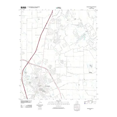
2010 Map of Waxahachie
USGS Topo · Published 2010About this map
The Waxahachie city center is the focal point of this 2010 survey, showing the preserved architectural heritage of North Texas through several designated areas. The Ellis County Courthouse Historic District and the North Rogers Street Historic District anchor the town’s core, while the Wyatt Street-Shotgun House Historic District highlights specific residential history. Beyond the city limits, the landscape transitions into the smaller rural settlements of Sterrett, Pecan Hill, and Rockett. Hydrology plays a significant role in the local geography, with Waxahachie Creek and Mustang Creek winding through the terrain, and several water management features like the Soil Conservation Service Site 14 Dam and Katy Lake Dam visible. For local history researchers, the map identifies landmarks such as the Bell Chapel Cemetery and the Second Trinity University Campus, alongside small aviation sites like O'Brien Airpark.
Find a feature on this map
76 named features on this map. Tap any name to fly to it.
Don’t see what you’re looking for? This feature index may not catch every label — zoom into the map to look around manually.
Map Details
Editions of this 2010 Waxahachie Map
This is the sole edition of this map. No revisions or reprints were ever made.
Other maps of this area

1891 · Dallas
USGS Topo · 1:125,000

1893 · Dallas
USGS Topo · 1:125,000

1954 · Dallas
USGS Topo · 1:250,000

1956 · Ennis
USGS Topo · 1:62,500

1958 · Dallas
USGS Topo · 1:250,000

1959 · Lancaster
USGS Topo · 1:24,000

1959 · Cedar Hill
USGS Topo · 1:24,000

1959 · Ferris
USGS Topo · 1:24,000

1959 · Seagoville
USGS Topo · 1:62,500

1960 · Boz
USGS Topo · 1:24,000