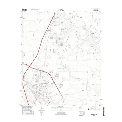
2016 Map of Waxahachie
USGS Topo · Published 2016About this map
Waxahachie and its northern neighbors, Red Oak and Sterrett, are documented here during a period of significant suburban expansion in Ellis County. The map captures the dense street grid of central Waxahachie, including the campus of the Southwestern Assemblies of God Univ and landmarks like Katy Lake. This landscape is defined by the convergence of major transportation corridors, with the Bnsf RR and several highways intersecting the terrain. Beyond the urban centers, smaller communities like Rockett and Pecan Hill sit among a drainage network of creeks such as Red Oak Cr and Mustang Cr. Local aviation history is represented by Barstool Ranch Airport and Hurn Airport, while family genealogy is anchored by sites like Bell Chapel Cem and Graves Cem.
Find a feature on this map
221 named features on this map. Tap any name to fly to it.
Don’t see what you’re looking for? This feature index may not catch every label — zoom into the map to look around manually.
Map Details
Editions of this 2016 Waxahachie Map
This is the sole edition of this map. No revisions or reprints were ever made.
Other maps of this area

1891 · Dallas
USGS Topo · 1:125,000

1893 · Dallas
USGS Topo · 1:125,000

1954 · Dallas
USGS Topo · 1:250,000

1956 · Ennis
USGS Topo · 1:62,500

1958 · Dallas
USGS Topo · 1:250,000

1959 · Lancaster
USGS Topo · 1:24,000

1959 · Cedar Hill
USGS Topo · 1:24,000

1959 · Ferris
USGS Topo · 1:24,000

1959 · Seagoville
USGS Topo · 1:62,500

1960 · Boz
USGS Topo · 1:24,000