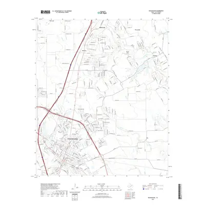
2019 Map of Waxahachie
USGS Topo · Published 2019About this map
Waxahachie anchors the southern portion of this Ellis County landscape, showing the city's complex grid and suburban expansion as it appeared in the late 2010s. The geography is defined by a series of north-south drainage systems, including Waxahachie Creek and Mustang Creek, which carve through the blackland prairie. Settlement patterns follow the historic corridors between major hubs, with smaller communities like Sterrett and Rockett situated along the rural routes that connect the larger centers of Red Oak and the county seat. This survey captures the region during a period of significant residential growth, where former ranch lands are transitioning into modern developments. Local history is preserved in sites such as Bell Chapel Cem and Graves Cem, while the inclusion of Barstool Ranch Airport and Hurn Airport highlights the area's ongoing connection to regional aviation.
Find a feature on this map
253 named features on this map. Tap any name to fly to it.
Don’t see what you’re looking for? This feature index may not catch every label — zoom into the map to look around manually.
Map Details
Editions of this 2019 Waxahachie Map
This is the sole edition of this map. No revisions or reprints were ever made.
Other maps of this area

1891 · Dallas
USGS Topo · 1:125,000

1893 · Dallas
USGS Topo · 1:125,000

1954 · Dallas
USGS Topo · 1:250,000

1956 · Ennis
USGS Topo · 1:62,500

1958 · Dallas
USGS Topo · 1:250,000

1959 · Lancaster
USGS Topo · 1:24,000

1959 · Cedar Hill
USGS Topo · 1:24,000

1959 · Ferris
USGS Topo · 1:24,000

1959 · Seagoville
USGS Topo · 1:62,500

1960 · Boz
USGS Topo · 1:24,000