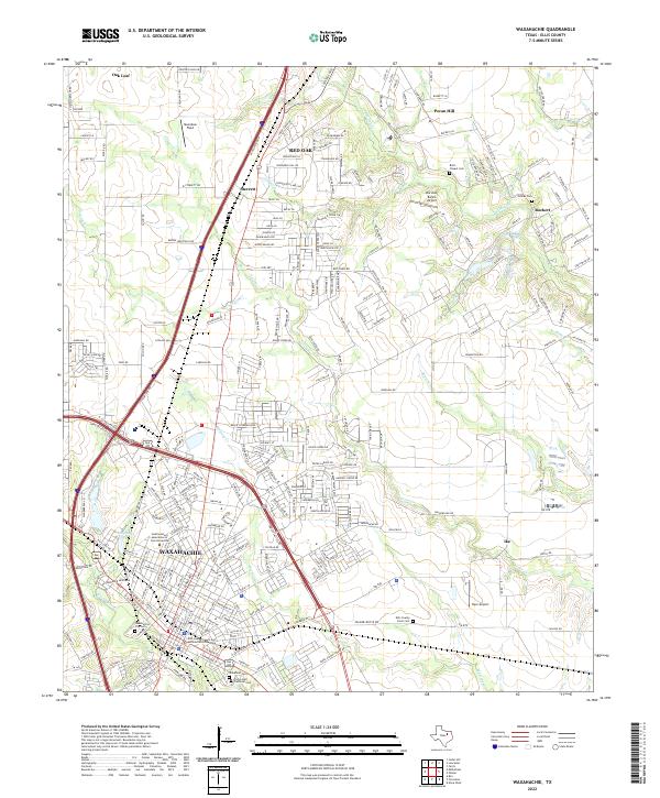
2022 Map of Waxahachie
USGS Topo · Published 2022About this map
Waxahachie and the surrounding Ellis County landscape are shown here during a period of sustained growth along the Interstate 35E corridor. The city serves as a regional hub, anchored by the Ellis County Courts and Administration Building and the campus of Southwestern Assemblies of God University. To the north, the communities of Red Oak, Sterrett, and Oak Leaf illustrate the suburban expansion filtering out from the Dallas-Fort Worth metroplex.
Find a feature on this map
248 named features on this map. Tap any name to fly to it.
Don’t see what you’re looking for? This feature index may not catch every label — zoom into the map to look around manually.
Map Details
Editions of this 2022 Waxahachie Map
This is the sole edition of this map. No revisions or reprints were ever made.
Other maps of this area

1891 · Dallas
USGS Topo · 1:125,000

1893 · Dallas
USGS Topo · 1:125,000

1954 · Dallas
USGS Topo · 1:250,000
1956 · Ennis
USGS Topo · 1:62,500

1958 · Dallas
USGS Topo · 1:250,000
1959 · Lancaster
USGS Topo · 1:24,000
1959 · Cedar Hill
USGS Topo · 1:24,000
1959 · Ferris
USGS Topo · 1:24,000
1959 · Seagoville
USGS Topo · 1:62,500
1960 · Boz
USGS Topo · 1:24,000