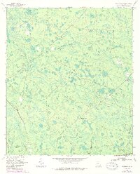
1967 Map of Waycross SW
USGS Topo · Published 1988About this map
Alligator Creek and the headwaters of the Suwannee River dominate this landscape on the border of Ware and Charlton counties. The terrain is a complex network of wetlands and upland "islands" such as Bush Island and Cane Break Island, intersected by an Old Railroad Grade and numerous firebreaks. Cultural landmarks are sparse but significant for local history, including the Pittman Chapel and Carter Cem. The presence of markers like Twelvemile Post and Fifteenmile Post along the Eightmile Post Road suggests an established system of distance marking through the dense swamp and pine woods. The naming of specific features like Botherment Swamp and Bear Belly Strand reflects the distinct local nomenclature of this pocket of the Georgia lowlands in the late 1960s.
Find a feature on this map
34 named features on this map. Tap any name to fly to it.
Don’t see what you’re looking for? This feature index may not catch every label — zoom into the map to look around manually.
Map Details
Editions of this 1967 Waycross SW Map
2 editions found

Other maps of this area

1953 · Waycross
USGS Topo · 1:250,000

1954 · Valdosta
USGS Topo · 1:250,000

1958 · Valdosta
USGS Topo · 1:250,000

1958 · Waycross
USGS Topo · 1:250,000

1959 · Valdosta
USGS Topo · 1:250,000

1965 · Dinner Pond
USGS Topo · 1:24,000

1966 · Cravens Island
USGS Topo · 1:24,000

1967 · Waycross SE
USGS Topo · 1:24,000

1967 · Spooner
USGS Topo · 1:24,000

1967 · Waycross West
USGS Topo · 1:24,000