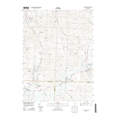
2013 Map of Waynesburg
USGS Topo · Published 2013About this map
Waynesburg and Magnolia anchor the southern reaches of this landscape, where the convergence of Sandy Creek and its many tributaries shaped the early development of the region. The map details a complex network of rural and suburban settlements, including East Sparta, Howenstine, and North Industry. For genealogists and local historians, the sheet is particularly dense with burial grounds, documenting sites such as Old Pioneer Cem, Sandy Valley Cem, and Melsheimer Cem.
Find a feature on this map
128 named features on this map. Tap any name to fly to it.
Don’t see what you’re looking for? This feature index may not catch every label — zoom into the map to look around manually.
Map Details
Editions of this 2013 Waynesburg Map
This is the sole edition of this map. No revisions or reprints were ever made.
Other maps of this area

1901 · Canton
USGS Topo · 1:62,500

1903 · Canton
USGS Topo · 1:62,500

1909 · Alliance
USGS Topo · 1:62,500

1910 · Carrollton
USGS Topo · 1:62,500

1912 · Dover
USGS Topo · 1:62,500

1912 · Carrollton
USGS Topo · 1:62,500

1944 · Dover
USGS Topo · 1:62,500

1951 · Canton
USGS Topo · 1:250,000

1951 · Bolivar
USGS Topo · 1:24,000

1953 · Canton
USGS Topo · 1:250,000