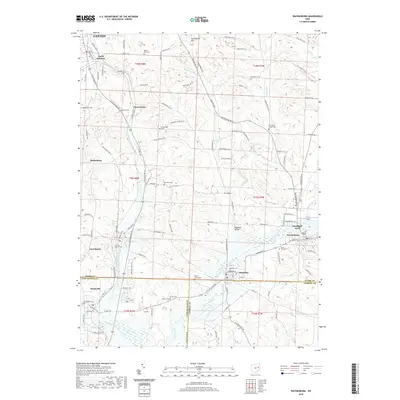
2019 Map of Waynesburg
USGS Topo · Published 2019About this map
Sandy Creek and its tributaries, including Indian Run and Hypocrite Run, define the rolling topography of southeastern Stark County. The village of Waynesburg serves as a local anchor near the intersection of the county lines, accompanied by established communities like East Sparta, Magnolia, and Sandyville. The landscape is a composite of agricultural fields and small residential pockets such as Goodland Acres, connected by a dense network of secondary roads and the Wheeling & Lake Erie RR. For genealogists, the map is particularly rich with burial grounds, ranging from the Old Pioneer Cem in Waynesburg to the Farber - Knotts Cem and Welsheimer Cem. These cemeteries, alongside landmarks like Fox Airport and Sponsellers Hill, provide a detailed record of the long-standing land ownership and community structure in this corner of Ohio.
Find a feature on this map
123 named features on this map. Tap any name to fly to it.
Don’t see what you’re looking for? This feature index may not catch every label — zoom into the map to look around manually.
Map Details
Editions of this 2019 Waynesburg Map
This is the sole edition of this map. No revisions or reprints were ever made.
Other maps of this area

1901 · Canton
USGS Topo · 1:62,500

1903 · Canton
USGS Topo · 1:62,500

1909 · Alliance
USGS Topo · 1:62,500

1910 · Carrollton
USGS Topo · 1:62,500

1912 · Dover
USGS Topo · 1:62,500

1912 · Carrollton
USGS Topo · 1:62,500

1944 · Dover
USGS Topo · 1:62,500

1951 · Canton
USGS Topo · 1:250,000

1951 · Bolivar
USGS Topo · 1:24,000

1953 · Canton
USGS Topo · 1:250,000