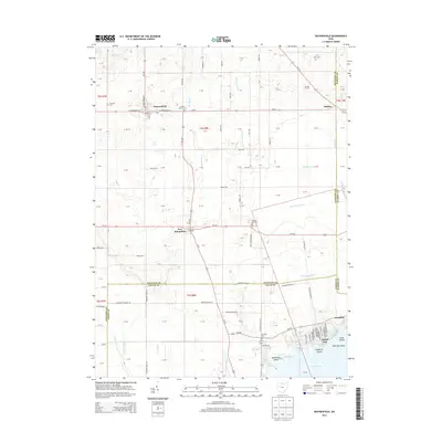
2013 Map of Waynesfield
USGS Topo · Published 2013About this map
Waynesfield serves as a primary hub in this early 21st-century landscape, where the grid of rural township roads meets state routes like Oh-196 and Oh-67. The region is defined by a systematic agricultural drainage network, evidenced by the Scioto River Ditch and the winding course of Muchinippi Cr. Smaller settlements such as New Hampshire and Holden anchor the surrounding farmland, while the southern edge of the map transitions into the recreational waters of Indian Lake. This shoreline area is densely plotted with distinct landforms like Chippewa Island and Blackhawk Island, contrasting with the open acreage of Sandee Farms to the north. Genealogists will find several well-preserved burial grounds throughout the townships, including Berry Cem near the eastern border and Willow Branch Cem along the central creek.
Find a feature on this map
119 named features on this map. Tap any name to fly to it.
Don’t see what you’re looking for? This feature index may not catch every label — zoom into the map to look around manually.
Map Details
Editions of this 2013 Waynesfield Map
This is the sole edition of this map. No revisions or reprints were ever made.
Other maps of this area

1906 · Lima
USGS Topo · 1:62,500

1913 · Alger
USGS Topo · 1:48,000

1913 · Bellefontaine
USGS Topo · 1:48,000

1913 · Sidney
USGS Topo · 1:62,500

1915 · Alger
USGS Topo · 1:62,500

1915 · Bellefontaine
USGS Topo · 1:62,500

1943 · Alger
USGS Topo · 1:62,500

1944 · Sidney
USGS Topo · 1:62,500

1944 · Bellefontaine
USGS Topo · 1:62,500

1950 · Marion
USGS Topo · 1:250,000