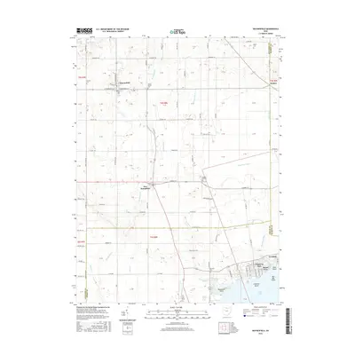
2016 Map of Waynesfield
USGS Topo · Published 2016About this map
Waynesfield stands as the primary settlement in this western Ohio landscape, where the headwaters of the Scioto River begin to take shape through a network of drainage channels like the Scioto River Ditch. The map reveals a transition from the agricultural grid of the northern sections to the recreational shoreline of Indian Lake in the south. This transition is marked by the presence of small rural hamlets like New Hampshire and the residential clusters at Island View and Avondale. Local history is preserved in several burial grounds, including Concord Cem and Walnut Hill Cem, which dot the township roads. The southern portion of the map provides a look at the developed lakefront, featuring Chippewa Island and Red Oak Island, while waterways like Muchinippi Cr and Van Horn Cr drain the surrounding farm acreage toward the Great Miami and Scioto watersheds.
Find a feature on this map
98 named features on this map. Tap any name to fly to it.
Don’t see what you’re looking for? This feature index may not catch every label — zoom into the map to look around manually.
Map Details
Editions of this 2016 Waynesfield Map
This is the sole edition of this map. No revisions or reprints were ever made.
Other maps of this area

1906 · Lima
USGS Topo · 1:62,500

1913 · Alger
USGS Topo · 1:48,000

1913 · Bellefontaine
USGS Topo · 1:48,000

1913 · Sidney
USGS Topo · 1:62,500

1915 · Alger
USGS Topo · 1:62,500

1915 · Bellefontaine
USGS Topo · 1:62,500

1943 · Alger
USGS Topo · 1:62,500

1944 · Sidney
USGS Topo · 1:62,500

1944 · Bellefontaine
USGS Topo · 1:62,500

1950 · Marion
USGS Topo · 1:250,000