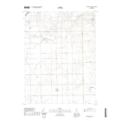
2021 Map of Waynesville West
USGS Topo · Published 2021About this map
The DeWitt and Logan County boundary line bisects this central Illinois landscape, where the headwaters of Kickapoo Creek wind through a patchwork of agricultural land. The village of Waynesville occupies the northeastern corner, anchored by the Union Cem, while smaller clusters like Beason, Tabor, and Midland City dot the southern reaches. This modern survey illustrates how long-standing family and community sites persist alongside newer infrastructure, including the private Hoblit Farms Airport and the historic corridor of Old Rte 66 clipping the northwest corner near the Atlanta Cem. Genealogy researchers will find an exceptional density of burial grounds throughout these townships, from the Jolly Cem and Bluegrass Cem in the north to Berryhill Cem, Perry Cem, and Keys Cem further south. The drainage patterns of Clear Cr and Deer Cr continue to define the local topography, much as they did for the earliest settlers of these rural precincts.
Find a feature on this map
40 named features on this map. Tap any name to fly to it.
Don’t see what you’re looking for? This feature index may not catch every label — zoom into the map to look around manually.
Map Details
Editions of this 2021 Waynesville West Map
This is the sole edition of this map. No revisions or reprints were ever made.
Other maps of this area

1911 · Lincoln
USGS Topo · 1:62,500

1913 · Lincoln
USGS Topo · 1:62,500

1949 · Mc Lean
USGS Topo · 1:62,500

1951 · McLean
USGS Topo · 1:62,500

1951 · Minier
USGS Topo · 1:62,500

1957 · Kenney
USGS Topo · 1:62,500

1958 · Peoria
USGS Topo · 1:250,000

1961 · Peoria
USGS Topo · 1:250,000

1963 · Peoria
USGS Topo · 1:250,000

1980 · Armington
USGS Topo · 1:24,000