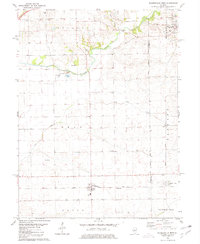
1980 Map of Waynesville West
USGS Topo · Published 1981About this map
The Third Principal Meridian divides the landscape of Central Illinois in the early 1980s, marking the border between Logan and De Witt counties. Small agricultural communities anchor the terrain, with Waynesville situated in the northeast and Beason further south. The transportation network is defined by the Illinois Terminal and Gulf Central railroads, which once facilitated the movement of grain and goods across these prairie townships.
Find a feature on this map
23 named features on this map. Tap any name to fly to it.
Don’t see what you’re looking for? This feature index may not catch every label — zoom into the map to look around manually.
Map Details
Editions of this 1980 Waynesville West Map
This is the sole edition of this map. No revisions or reprints were ever made.
Other maps of this area

1911 · Lincoln
USGS Topo · 1:62,500

1913 · Lincoln
USGS Topo · 1:62,500

1949 · Mc Lean
USGS Topo · 1:62,500

1951 · McLean
USGS Topo · 1:62,500

1951 · Minier
USGS Topo · 1:62,500

1957 · Kenney
USGS Topo · 1:62,500

1958 · Peoria
USGS Topo · 1:250,000

1961 · Peoria
USGS Topo · 1:250,000

1963 · Peoria
USGS Topo · 1:250,000

1980 · Armington
USGS Topo · 1:24,000