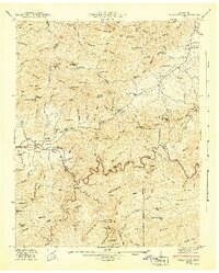
1942 Map of Wear Cove
USGS Topo · Published 1942About this map
Great Smoky Mountains National Park occupies the southern half of this mid-century survey, where the Little River carves a deep gorge through the mountains. The landscape is defined by the contrast between the flat, settled lands of Tuckaleechee Cove and Wear Cove, and the steep ridges like Bates Mountain and Hatcher Mountain. This 1941 field revision captures the rural infrastructure of Blount and Sevier Counties, documenting numerous small community hubs such as Coker Hill School and Wearwood School.
Find a feature on this map
146 named features on this map. Tap any name to fly to it.
Don’t see what you’re looking for? This feature index may not catch every label — zoom into the map to look around manually.
Map Details
Editions of this 1942 Wear Cove Map
2 editions found
Other maps of this area

1886 · Knoxville
USGS Topo · 1:125,000

1892 · Knoxville
USGS Topo · 1:125,000

1894 · Knoxville
USGS Topo · 1:125,000

1895 · Knoxville
USGS Topo · 1:125,000

1901 · Knoxville
USGS Topo · 1:125,000

1935 · Knoxville
USGS Topo · 1:48,000

1935 · Walden Creek
USGS Topo · 1:24,000

1935 · Wildwood
USGS Topo · 1:24,000

1935 · Sevierville
USGS Topo · 1:48,000
1935 · Pigeon Forge
USGS Topo · 1:24,000