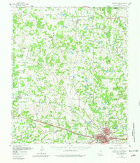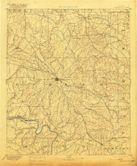
1893 Map of Weatherford
USGS Topo · Published 1919About this map
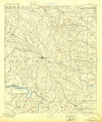
The Weatherford townsite serves as the central hub of this reconnaissance survey, situated at the junction of the Texas and Pacific Railway and various overland routes. To the south, the Brazos River carves a winding path through Big Valley, where river crossings like Powell Ferry, Maxwell Crossing, and Stephensville Crossing reveal the vital points of passage for 19th-century travelers before modern bridging. The landscape is dotted with early rural settlements and landmarks, including the frontier post office at Bear Creek P.O. and the localized industry of Center Mill. Geologic features such as Indian Knob, Skeen Peak, and Burton Knob define the elevation changes between the West Fork of Trinity River and the Brazos, illustrating the rugged north-central Texas terrain as it was recorded just decades after Parker County's organization.
Find a feature on this map
80 named features on this map. Tap any name to fly to it.
Don’t see what you’re looking for? This feature index may not catch every label — zoom into the map to look around manually.
Map Details
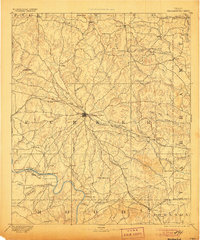
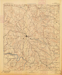
Editions of this 1893 Weatherford Map
5 editions found

Historical Maps of Fort Worth Through Time
3 maps found