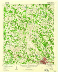
1959 Map of Weatherford
USGS Topo · Published 1960About this map
Weatherford and the central Parker County countryside are documented here at a moment of significant infrastructure expansion in the late 1950s. The landscape is characterized by the confluence of the Clear Fork Trinity River and numerous tributaries like Willow Creek and Grandstone Creek, punctuated by prominent terrain features such as Slipdown Mtn and Bald Knob. While the regional economy is anchored by the Toto Gas Field and active Gravel Pits, the map reveals a deeply rooted rural social fabric. Small communities like Poolville, Peaster, and Agnes are defined by local landmarks including Lone Star Ch and Bethesda Cem. The transport network shows the era's transition, with the Texas and Pacific and Weatherford Mineral Wells and Northwestern railroads crossing the terrain alongside a developing grid of county roads connecting family-named landmarks and schools like Bowie Sch.
Find a feature on this map
65 named features on this map. Tap any name to fly to it.
Don’t see what you’re looking for? This feature index may not catch every label — zoom into the map to look around manually.
Map Details
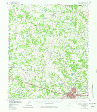
Editions of this 1959 Weatherford Map
2 editions found
Other maps of this area

1891 · Weatherford
USGS Topo · 1:125,000

1891 · Palo Pinto
USGS Topo · 1:125,000

1893 · Weatherford
USGS Topo · 1:125,000

1918 · Palo Pinto
USGS Topo · 1:125,000

1927 · Mineral Wells
USGS Topo · 1:62,500

1930 · Boyd
USGS Topo · 1:62,500

1931 · Dennis
USGS Topo · 1:62,500

1931 · Santo
USGS Topo · 1:62,500

1932 · Springtown
USGS Topo · 1:62,500

1954 · Dallas
USGS Topo · 1:250,000