
1972 Map of Weavers Station
USGS Topo · Published 1976About this map
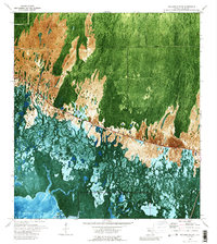
The Tamiami Trail bisects this Florida landscape, serving as the primary corridor through the complex wetlands of Everglades National Park. To the north, the terrain transitions between the expansive Fakahatchee Strand and open grasslands like Dan House Prairie and Four Stake Prairie. The map's orthophotomap format vividly captures the intricate drainage patterns of the region, where a network of water bodies including the Fakahatchee River, East River, and Ferguson River flow toward the coast. The southern portion of the sheet reveals the tidal complexities of Fakahatchee Bay and Ferguson Bay, punctuated by Daniels Point. Along the main roadway, the Roadside Park and the intersection with Grove Road indicate the few established points of human infrastructure in this predominantly watery wilderness.
Find a feature on this map
16 named features on this map. Tap any name to fly to it.
Don’t see what you’re looking for? This feature index may not catch every label — zoom into the map to look around manually.
Map Details
Editions of this 1972 Weavers Station Map
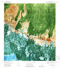
3 editions found
Other maps of this area

1956 · Miami
USGS Topo · 1:250,000

1956 · West Palm Beach
USGS Topo · 1:250,000

1957 · West Palm Beach
USGS Topo · 1:250,000

1958 · West Palm Beach
USGS Topo · 1:250,000

1958 · Miami
USGS Topo · 1:250,000

1958 · Belle Meade SE
USGS Topo · 1:24,000

1959 · Deep Lake
USGS Topo · 1:24,000

1959 · Deep Lake SW
USGS Topo · 1:24,000

1972 · Ochopee
USGS Topo · 1:24,000
1973 · Royal Palm Hammock
USGS Topo · 1:24,000