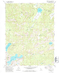
1981 Map of Webber Peak
USGS Topo · Published 1987About this map
Webber Peak and the high elevations of the Tahoe National Forest dominate this landscape, where the boundary between Sierra County and Nevada County cuts through a network of alpine lakes and meadows. The area serves as a critical hydrologic crossroads, with the Little Truckee River and Perazzo Creek draining the eastern slopes while the headwaters of the Fordyce Lake system sit to the southwest. Human influence in this high-altitude terrain is marked by extractive history and traditional transit routes, including the Anderson Mine near the lake shores and the historic corridor of Henness Pass. Modern recreation and preservation are represented by the Pacific Crest National Scenic Trail as it winds across the ridges, providing a clear view of how the land transitioned from a resource-driven frontier to a protected recreational wilderness by the early 1980s.
Find a feature on this map
31 named features on this map. Tap any name to fly to it.
Don’t see what you’re looking for? This feature index may not catch every label — zoom into the map to look around manually.
Map Details
Editions of this 1981 Webber Peak Map
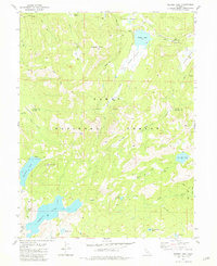
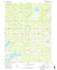
3 editions found
Other maps of this area

1890 · Sierraville
USGS Topo · 1:125,000

1891 · Downieville
USGS Topo · 1:125,000

1891 · Colfax
USGS Topo · 1:125,000

1891 · Truckee
USGS Topo · 1:125,000

1892 · Sierraville
USGS Topo · 1:125,000

1892 · Colfax
USGS Topo · 1:125,000

1893 · Truckee
USGS Topo · 1:125,000

1893 · Downieville
USGS Topo · 1:125,000

1894 · Colfax
USGS Topo · 1:125,000

1894 · Sierraville
USGS Topo · 1:125,000