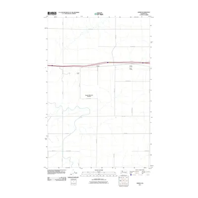
2011 Map of Weber
USGS Topo · Published 2011About this map
Warden Hutterian Brethren stands as a focal point in this eastern Washington landscape, reflecting the region's communal agricultural heritage. The terrain is defined by the distinct drainage patterns of Bauer Coulee and Farrier Coulee, which cut through a strictly organized grid of rural roads. Transport and commerce are evidenced by the presence of Weber and the industrial siding at Schaeffer Spur, situated along the rail corridor. The map's extensive network of local routes, such as W Weber Rd and N Howard Rd, illustrates the intensive land use and connectivity required for modern farming operations in Adams County. This 2011 record documents a landscape where traditional community settlements and modern transportation infrastructure intersect among the dry coulees.
Find a feature on this map
26 named features on this map. Tap any name to fly to it.
Don’t see what you’re looking for? This feature index may not catch every label — zoom into the map to look around manually.
Map Details
Editions of this 2011 Weber Map
This is the sole edition of this map. No revisions or reprints were ever made.
Other maps of this area

1916 · Connell
USGS Topo · 1:125,000

1918 · Connell
USGS Topo · 1:125,000

1923 · Wheeler
USGS Topo · 1:62,500

1924 · Othello
USGS Topo · 1:62,500

1925 · Wheeler
USGS Topo · 1:62,500

1925 · Schrag
USGS Topo · 1:62,500

1953 · Walla Walla
USGS Topo · 1:250,000

1953 · Ritzville
USGS Topo · 1:250,000

1954 · Warden
USGS Topo · 1:24,000

1954 · Othello
USGS Topo · 1:62,500