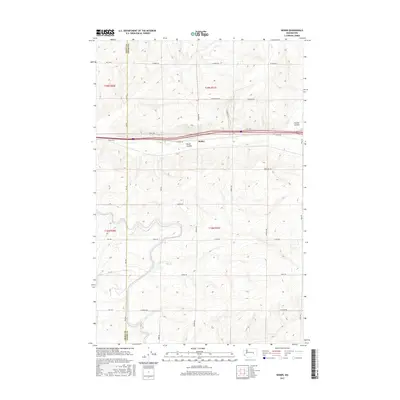
2017 Map of Weber
USGS Topo · Published 2017About this map
Weber and its surrounding agricultural landscape dominate this central Washington territory at the border of Grant Co and Adams Co. The terrain is defined by dry watercourses such as Bauer Coulee and Farrier Coulee, which cut through the high plains. A rigid grid of rural roads, including W Weber Rd and W Schrag Rd, illustrates the highly organized land use of the late 20th and early 21st centuries. The township and range system is clearly demarcated by t19n r30e and t19n r31e markers, showing the precise division of acreage for large-scale farming. Notable family-named routes like Leisle Rd, Franz Rd, and Sackman Rd provide valuable clues for genealogists tracing property holdings and local movement within these vast inland plateaus.
Find a feature on this map
33 named features on this map. Tap any name to fly to it.
Don’t see what you’re looking for? This feature index may not catch every label — zoom into the map to look around manually.
Map Details
Editions of this 2017 Weber Map
This is the sole edition of this map. No revisions or reprints were ever made.
Other maps of this area

1916 · Connell
USGS Topo · 1:125,000

1918 · Connell
USGS Topo · 1:125,000

1923 · Wheeler
USGS Topo · 1:62,500

1924 · Othello
USGS Topo · 1:62,500

1925 · Wheeler
USGS Topo · 1:62,500

1925 · Schrag
USGS Topo · 1:62,500

1953 · Walla Walla
USGS Topo · 1:250,000

1953 · Ritzville
USGS Topo · 1:250,000

1954 · Warden
USGS Topo · 1:24,000

1954 · Othello
USGS Topo · 1:62,500