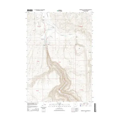
2015 Map of Wedding of the Waters
USGS Topo · Published 2015About this map
Wedding of the Waters marks a significant hydrologic transition point where the southward-flowing Wind River is renamed the Bighorn River as it enters the canyon. This 2015 survey illustrates the complex topography of Hot Springs County, where the settlement of Minnesela sits near the river’s bend. The landscape is defined by deep incisions such as Black Canyon, Teeter Canyon, and Deer Canyon, which funnel drainage from the surrounding high ground toward the central river valley.
Find a feature on this map
43 named features on this map. Tap any name to fly to it.
Don’t see what you’re looking for? This feature index may not catch every label — zoom into the map to look around manually.
Map Details
Editions of this 2015 Wedding of the Waters Map
This is the sole edition of this map. No revisions or reprints were ever made.
Other maps of this area

1951 · Boysen
USGS Topo · 1:24,000

1951 · Birdseye Pass
USGS Topo · 1:24,000

1951 · Morrison Canyon
USGS Topo · 1:24,000

1955 · Thermopolis
USGS Topo · 1:250,000

1958 · Thermopolis
USGS Topo · 1:250,000

1960 · Devil Slide
USGS Topo · 1:24,000

1960 · Red Hole
USGS Topo · 1:24,000
1960 · Wedding Of The Waters
USGS Topo · 1:24,000

1960 · Thermopolis
USGS Topo · 1:24,000

1962 · Thermopolis
USGS Topo · 1:250,000