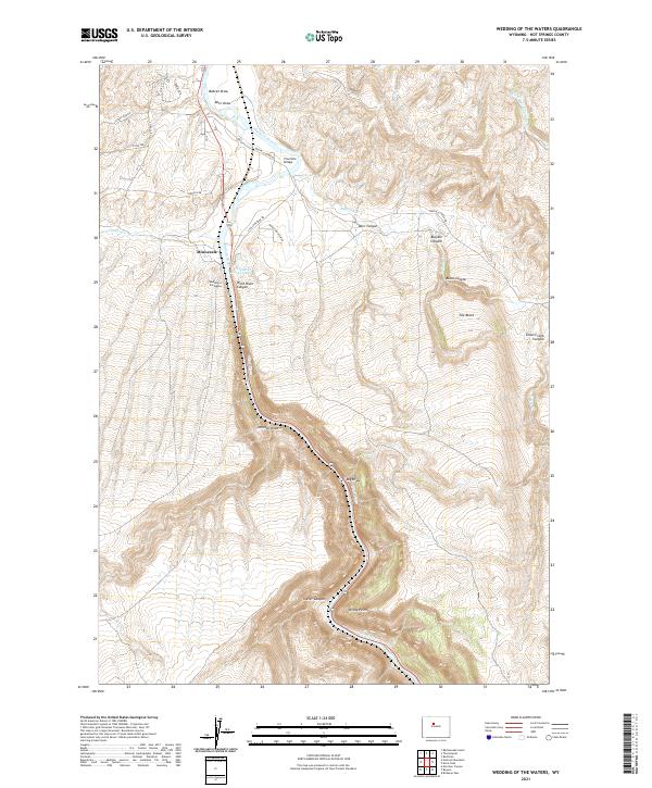
2021 Map of Wedding of the Waters
USGS Topo · Published 2021About this map
The Wind River transitions into the Bighorn River at the distinctive landmark known as the Wedding of the Waters, a geographic name for the point where the river flows out of the deep canyon into the open basin. This 2021 survey of the Hot Springs region shows the river winding through steep terrain characterized by massive formations like The Block and the sharp lookout at Windy Point. The small settlement of Minnesela sits along the western bank near the river's transition point, connected by a network of rural roads including S Yellowstone Rd and Buffalo Creek Rd. The landscape is deeply incised by numerous seasonal watercourses and topographic features such as Teeter Canyon, Buffalo Canyon, and Johnson Draw. For the researcher, this map provides a clear view of the modern road access and land management boundaries in this high-desert canyon environment.
Find a feature on this map
36 named features on this map. Tap any name to fly to it.
Don’t see what you’re looking for? This feature index may not catch every label — zoom into the map to look around manually.
Map Details
Editions of this 2021 Wedding of the Waters Map
This is the sole edition of this map. No revisions or reprints were ever made.
Other maps of this area

1951 · Boysen
USGS Topo · 1:24,000

1951 · Birdseye Pass
USGS Topo · 1:24,000

1951 · Morrison Canyon
USGS Topo · 1:24,000

1955 · Thermopolis
USGS Topo · 1:250,000

1958 · Thermopolis
USGS Topo · 1:250,000

1960 · Devil Slide
USGS Topo · 1:24,000

1960 · Red Hole
USGS Topo · 1:24,000
1960 · Wedding Of The Waters
USGS Topo · 1:24,000

1960 · Thermopolis
USGS Topo · 1:24,000

1962 · Thermopolis
USGS Topo · 1:250,000