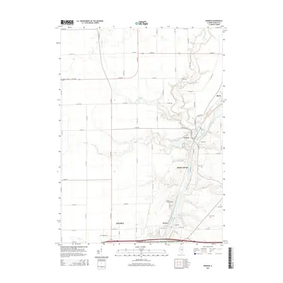
2015 Map of Wedron
USGS Topo · Published 2015About this map
The Fox River carves a deep path through LaSalle County, shaping the landscape near settlements like Wedron and Dayton. This area is defined by the convergence of several waterways, including Indian Creek, Buck Cr, and Crookedleg Cr, which feed into the main river channel. The map highlights a mix of rural agricultural land and recreation, most notably the Illinois and Michigan Canal National Heritage Corridor along the southern edge. Local history is anchored by several named burial grounds, such as Freedom Lutheran Cem and Trumbo Cem, which serve as vital markers for genealogical research. The presence of the Skydive Chicago Airport near Sulphur Springs adds a modern aviation element to this traditionally river-oriented geography, while the grid of rural roads like N 39th Rd and E 18th Rd facilitates movement across the township sections.
Find a feature on this map
54 named features on this map. Tap any name to fly to it.
Don’t see what you’re looking for? This feature index may not catch every label — zoom into the map to look around manually.
Map Details
Editions of this 2015 Wedron Map
This is the sole edition of this map. No revisions or reprints were ever made.
Other maps of this area

1892 · Marseilles
USGS Topo · 1:62,500

1892 · Ottawa
USGS Topo · 1:62,500

1915 · Ottawa
USGS Topo · 1:62,500

1916 · Marseilles
USGS Topo · 1:62,500

1940 · Marseilles
USGS Topo · 1:62,500

1946 · Ottawa
USGS Topo · 1:62,500

1948 · Sandwich
USGS Topo · 1:62,500

1950 · Sandwich
USGS Topo · 1:62,500

1951 · Earlville
USGS Topo · 1:62,500

1958 · Aurora
USGS Topo · 1:250,000