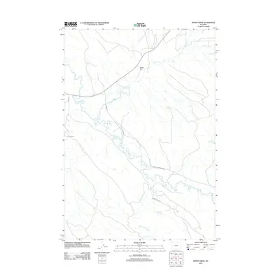
2012 Map of Weintz Draw
USGS Topo · Published 2012About this map
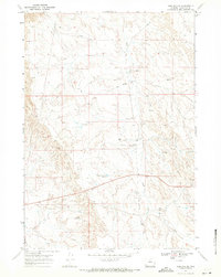
The Bonanza Oil Field anchors the western edge of this Big Horn County landscape, where the meandering Nowood River cuts through the terrain. This 2012 survey illustrates a complex network of water management essential to the high desert, featuring the Ninetysix Canal and the Anita Ditch. These irrigation features, along with several cattle or irrigation ponds like Brewster Reservoir and H G Reservoir, trace the legacy of ranching and resource extraction in the region. The map also delineates the eponymous Weintz Draw and the course of Paint Rock Cr as they feed into the larger river system. Rural transportation is marked by local connectors such as Tensleep Manderson Rd and Bentonite Ridge Rd, which provide access to the remote ridges and oil works that define the area's modern economic character.
Find a feature on this map
16 named features on this map. Tap any name to fly to it.
Don’t see what you’re looking for? This feature index may not catch every label — zoom into the map to look around manually.
Map Details
Editions of this 2012 Weintz Draw Map
This is the sole edition of this map. No revisions or reprints were ever made.
Other maps of this area

1955 · Sheridan
USGS Topo · 1:250,000

1958 · Sheridan
USGS Topo · 1:250,000

1960 · Flitner Reservoir
USGS Topo · 1:24,000

1960 · Hyatt Ranch
USGS Topo · 1:24,000

1960 · Manderson SE
USGS Topo · 1:24,000

1962 · Sheridan
USGS Topo · 1:250,000
1967 · Hyattville
USGS Topo · 1:24,000
1967 · Weintz Draw
USGS Topo · 1:24,000
1967 · Broom Draw
USGS Topo · 1:24,000
1967 · Worland SE
USGS Topo · 1:24,000